
Configuring ESRI Map Layers
Overview
This guide explains how to configure ESRI map layers in EPR FireWorks. Configuring ESRI map layers enables Geographic Information System (GIS) integration and spatial data management within the FireWorks system. Once configured, these layers provide critical geographic context for incident response and operational planning.
Before you start
Before you configure ESRI map layers, ensure:
You have administrator access to the EPR FireWorks Back-Office.
Your department has valid ESRI service credentials or endpoints.
You understand which GIS data layers your department needs to display.
Configure ESRI map layers
This procedure describes how to configure geographic data layers that appear in FireWorks modules for operational use.
Navigate to Department Configuration.
Click the ESRI Map Layers tab.
Add layer information for each map layer you need to configure:
In the Description column, add the layer name.
In the URL column, paste the ESRI layer URL.
Select the layer type:
For vector data, such as points, lines, and polygons representing geographic features (e.g., buildings, roads, parcels), select Feature.
For raster data, such as pixel grids and aerial images, select Imagery.
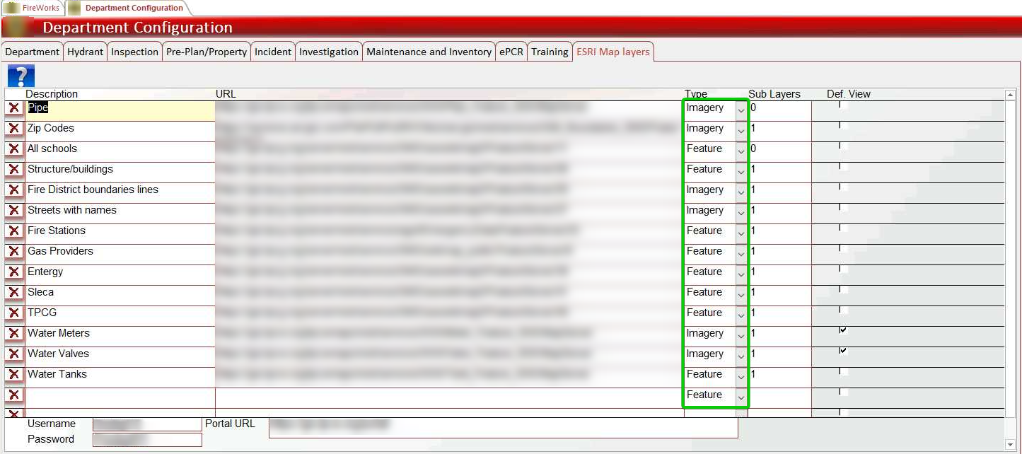
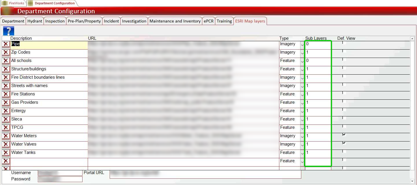
In the Sublayers column, type the number of sublayers included in the layer.
Configure default visibility by checking Def Value for layers that should appear when opening maps in FireWorks.
Save your configuration.
Result: Configured layers now appear in FireWorks modules based on your visibility settings.
Important: To verify layer information, paste the layer's URL in your browser to view the ArcGIS REST Services Directory. Ensure the sublayer count is accurate—incorrect sublayer numbers prevent proper layer functionality.
Configure protected property layers
For layers requiring additional authentication, add your local ESRI portal credentials.
Click the desired layer from the ESRI layers list.
Add authentication credentials (scroll down to the bottom of the table for tables with multiple layers):
In the Portal URL field, paste the local ESRI portal URL.
In the Username field, enter your portal username.
In the Password field, enter your portal password.

Important: Protected property layers without proper credentials will not display on maps.