
Switching to Map View
Overview
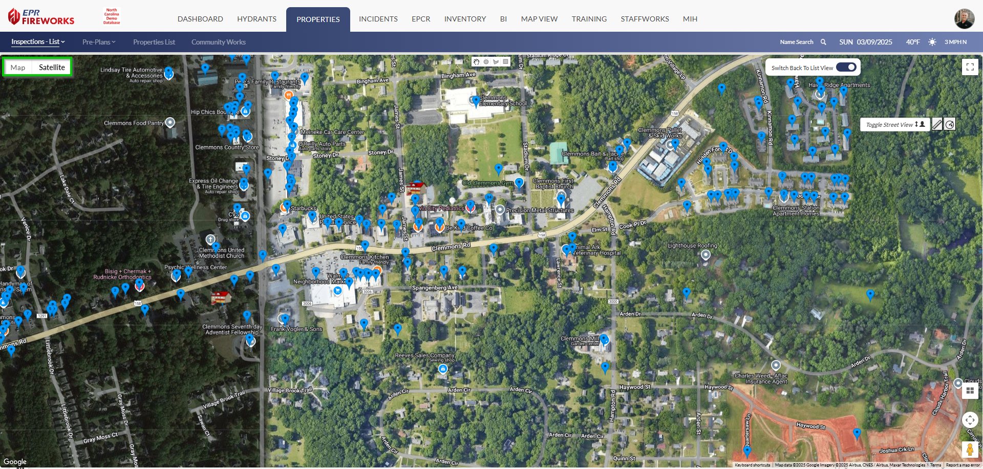
Map View displays properties in a geographic interface, allowing you to visualize property locations across your jurisdiction. This view helps you:
Identify property clusters and distribution patterns.
Plan efficient inspection routes based on location.
Visualize coverage areas for planning purposes.
Switching to Map View
Click Switch to Map View (Located at the top of the List pages).

Navigate the map using the following controls:
Toggle between Map and Satellite views using the buttons in the top left.
Zoom in and out using the + and - buttons or ctrl+mouse wheel.
Pan by clicking and dragging the map.
Click the full-screen icon in the top right to expand the map.
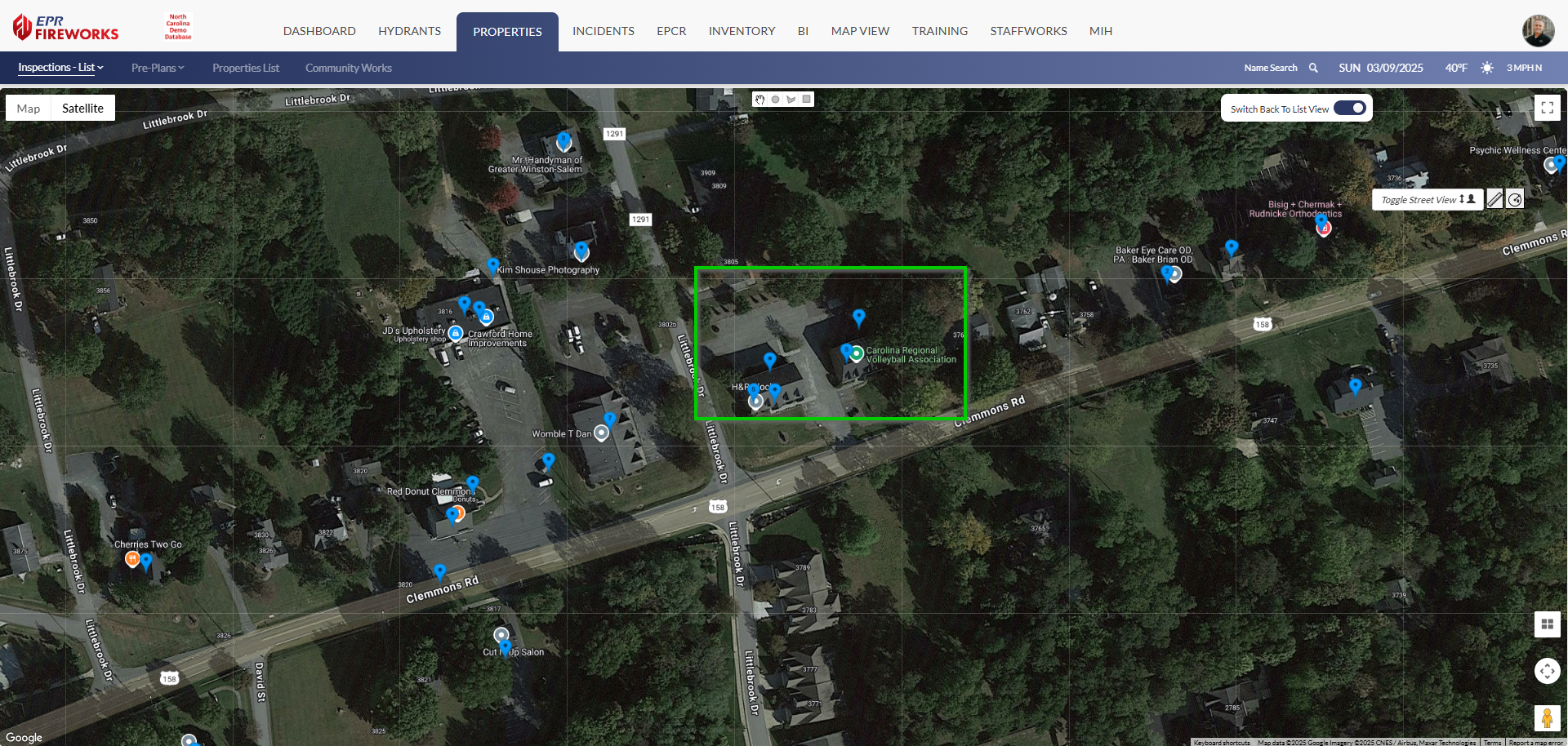
Property Clusters
For areas containing multiple properties, a numerical indicator displays the total count.
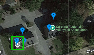
Click the cluster indicator to zoom in and view individual property markers in that area.
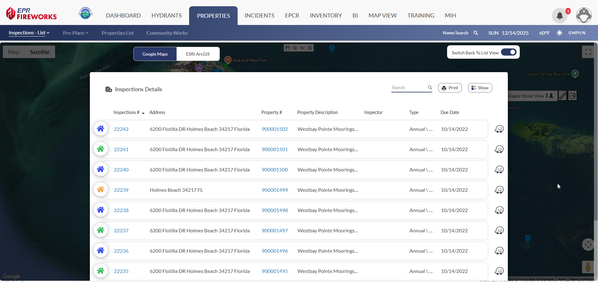
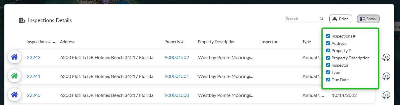
Column Display
You can now control column display for multiple property lists.
Click Show on the top right of the list.
Select applicable columns.
Additional Map Features
The map interface includes several helpful features:
Toggle Street View: Click the "Toggle Street View" button in the top right to access Google Street View.

Map/Satellite Toggle: Switch between standard map and satellite imagery using the buttons in the top left.
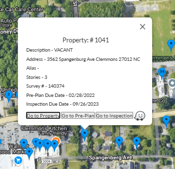
Property Information: Click on any property marker to view basic details and access full property information.
Returning to List View
To switch back to the list, click Switch Back to List View at the top right of the map.

Note: Any filters applied in List View will remain active in Map View, and vice versa.